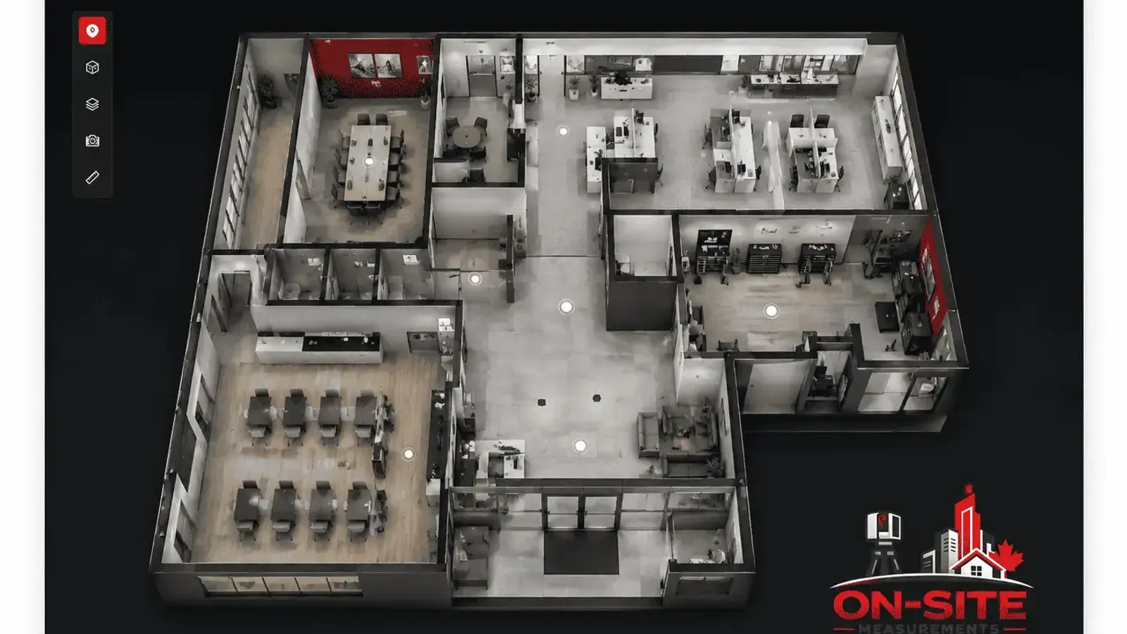
TL;DR: Facility documentation is a current, measured record of a building that the operations team can actually use: floor plans that match the walls, reflected ceiling plans that show where fixtures and access panels are, and a visual reference people can open without a site visit. It is usually built from one laser scanning visit, then delivered as as-built drawings, a point cloud and, where it helps, a hosted virtual tour. The useful order is to fix the records you rely on most often first, and to keep the scan so later requests do not need a new visit.
Most property and facility managers inherit their drawings. Some came from the original design team, some from a tenant fit-out a decade ago, some were redrawn by hand from a fire plan. Over time the set drifts away from the building, and the gap shows up at bad moments: a contractor quoting off the wrong ceiling height, a lease plan that does not match the demising wall, a mechanical room nobody can describe over the phone.
What does facility documentation actually include?
The term is broad, so it helps to break it into the records operations teams use day to day. A typical package draws on three deliverable types, all produced from the same site visit:
| Deliverable | What the facility team uses it for | Typical format |
|---|---|---|
| As-built floor plans, sections and elevations | Space and lease plans, renovation briefs, contractor bid packages, life safety plan updates | DWG and PDF |
| Reflected ceiling plans | Lighting and fixture records, sprinkler and diffuser locations, access panel locations for maintenance | DWG and PDF |
| Registered point cloud | Answering new measurement questions later without a return visit, handing existing conditions to designers | E57, RCP/RCS |
| Hosted 3D virtual tour | Remote orientation for contractors, insurers, brokers and head office staff | Web link |
The drawings are drafted by a technician from the scan data, so every line has a measured source. The point cloud is the evidence behind the drawings. The tour is a visual reference, not a measured record: its measurements are approximate, which is why it sits alongside drawings rather than replacing them. Our as-built drawings service and 3D virtual tours service pages explain each deliverable in more detail.
Which records should a facility team update first?
Not every drawing needs to be redone at once. A sensible order follows how often a record is used and how expensive an error in it would be.
- Floor plans for leased or leasable space. If rent, recoveries or tenant improvement allowances depend on area, the plans behind them need to match the building. The BOMA office building case study in Toronto shows how a property management firm used a full scan to rebuild its floor plans and fixture records before leasing.
- Mechanical, electrical and service rooms. These are the spaces contractors ask about most and the ones least likely to match old drawings, because equipment gets replaced and rerouted over the years. A scan records what is there now: equipment positions, clearances and visible piping and duct runs.
- Ceilings in occupied areas. A reflected ceiling plan answers a steady stream of maintenance questions: where the access panels are, which fixtures were changed, where sprinkler heads and diffusers sit. It also saves time on every future fit-out.
- Roofs and exteriors. For roof equipment, envelope work or capital planning, drone services can document roof conditions and the exterior from the air in the same project.
Areas that cannot be seen, such as services above a closed hard ceiling or inside walls, are not part of a scan-based record. If a later project opens those areas, they can be captured then and added to the set.
How does a facility documentation project run?
The process is the same whether the building is an office tower, a school or a warehouse.
- Scoping. You send the address, building type, approximate area and the records you need. We confirm which areas are included, which deliverables, and any access limits such as tenant hours, secured rooms or shutdown windows.
- Site visit. 3D laser scanning captures the visible surfaces of each area from a series of scanner positions. Occupied buildings are usually scanned around the tenants, with secured spaces visited by appointment. Coverage checks are completed while on site when practical, and registration quality is reviewed during processing before deliverables are issued.
- Processing and drafting. The scans are registered into one coordinate system, and a technician drafts the drawings from the point cloud to the agreed level of detail. Tours are processed and hosted separately.
- Delivery. You receive the drawings, the point cloud and any tour link, together with notes on areas that were not accessible.
Because the drawings are drafted by a person rather than generated automatically, the scope has to state what is shown: room names, door swings, fixtures, equipment tags or none of these. That is the single biggest factor in how long drafting takes, so it is worth being specific.
How do property managers use the records after delivery?
The value of facility documentation shows up over years, not on the delivery date. Common uses we see:
- Contractor bid packages. Sending accurate existing conditions with a request for pricing can reduce the allowances and unknowns contractors build into their numbers.
- Remote orientation. A virtual tour lets a contractor, broker or insurer understand a space before they arrive, and lets head office staff review a site in another city without travelling.
- Capital planning. Equipment rooms and roofs documented at one point in time give the next consultant a starting point instead of a blank page.
- Design handoff. When a renovation starts, the architect or engineer can work from the point cloud and drawings, or order a Scan to BIM model for the affected areas, without starting the measurement again.
The facility management team decides how the records are used. On-Site Measurements produces the measured record; it does not provide engineering assessments, building condition reports or code compliance reviews.
What should you keep, and how should you store it?
Facility records are only useful if the next person can find them. A few habits help:
- Keep the point cloud, not only the PDFs. The E57 file, an open format published by ASTM as standard E2807, is the reusable asset. A later question such as "what is the clear height under that beam?" can often be answered from it in minutes.
- Store DWG and PDF together. PDFs are for reading and sharing; DWG files are what the next designer or drafter will edit.
- Note the capture date on every sheet. Buildings keep changing. A dated record tells the next reader how far to trust it.
- Plan for tour hosting. Virtual tours are hosted online and stay live while the hosting subscription is active, so decide early who owns that account.
How is facility documentation scoped in Toronto, Vancouver and other cities?
The method is the same across Canada, but the building stock shapes the conversation.
- Toronto portfolios lean toward multi-tenant offices and mixed-use buildings with many generations of fit-out. Floor-by-floor drawing updates and ceiling plans are the common request. See as-built drawings in Toronto.
- Vancouver property teams often manage older and heritage buildings alongside newer towers, and remote access matters for owners outside the region. See 3D virtual tours in Vancouver.
- Calgary requests often involve industrial and warehouse facilities where equipment layouts and clearances matter more than finishes. See 3D laser scanning in Calgary.
On-Site Measurements serves projects in Ottawa, Montreal and Edmonton on the same basis.
Frequently asked questions
Can you document a building while it is occupied?
Usually, yes. Most facility documentation is scanned during normal operations, working around tenants and scheduling secured or sensitive rooms by appointment. Access limits are confirmed during scoping.
Do we need drawings, a virtual tour, or both?
Drawings are the measured record for leasing, design and contractor pricing. A tour is a visual reference for people who need to see the space. Many facility teams start with drawings and add a tour for spaces that are often viewed remotely.
Can you update only part of a building?
Yes. Many owners start with leasable floors or the main mechanical rooms and add other areas later. A dated point cloud from each visit can be combined with later captures.
Can the drawings be imported into our facility management software?
DWG files are the common input for most space and facility management platforms. Tell us the platform and any layer or naming standard during scoping so the drawings are prepared to match.
Do you provide building condition assessments?
No. A scan records geometry and visible conditions, but it is not an engineering or condition assessment. Your engineer or assessor can use the scan and drawings as a reference for that work.
Related reading
- What is an as-built floor plan?, what the core facility drawing contains
- Commercial and industrial as-built floor plans, what changes in larger buildings
- What to expect during a 3D scanning site visit, how the field day works in an occupied building
- Building documentation for facility management teams, services and project types for operations teams
If your building records no longer match the building, send the address, the building type, the areas you want documented and how the records will be used. We will confirm the capture plan and return a fixed-scope quote within 24 hours. Request a quote or read more field notes.