Existing-Condition Documentation for Engineering Teams
On-Site Measurements supports engineering teams with point-cloud data, CAD and BIM inputs, spatial context, and field documentation for MEP coordination, retrofit review, existing-condition understanding, and engineering workflows. The company does not provide engineering services or stamped deliverables.
Serving projects across Canada
Measurement and documentation support for engineering teams across Canada
Documentation support for engineering firms teams

What This Documentation Supports
MEP coordination in existing buildings
When mechanical, electrical, or plumbing systems need to be documented for coordination, expansion, or retrofit work in existing buildings.
Retrofit planning and existing-condition review
When engineering teams need to understand existing conditions before developing a retrofit scope, replacement strategy, or equipment upgrade plan.
CAD or BIM input for engineering workflows
When existing building geometry, equipment positions, or spatial context is needed as input for engineering drawings or coordination models.
Structural or spatial reference
When existing structural elements, floor-to-ceiling dimensions, or column grid information needs to be confirmed before engineering work begins.
When Engineering Teams Need Documentation Support
Engineering teams often need reliable field documentation and spatial context before developing retrofit scopes, coordination models, or detailed engineering inputs. These are the most common triggers.
- 01
MEP coordination in existing buildings
When mechanical, electrical, or plumbing systems need to be documented for coordination, expansion, or retrofit work in existing buildings.
- 02
Retrofit planning and existing-condition review
When engineering teams need to understand existing conditions before developing a retrofit scope, replacement strategy, or equipment upgrade plan.
- 03
CAD or BIM input for engineering workflows
When existing building geometry, equipment positions, or spatial context is needed as input for engineering drawings or coordination models.
- 04
Structural or spatial reference
When existing structural elements, floor-to-ceiling dimensions, or column grid information needs to be confirmed before engineering work begins.
- 05
Field verification against drawings
When site measurements need to be verified against record drawings, or when drawing discrepancies need to be resolved before engineering can proceed.
Services Most Relevant to Engineering Firms
The following services are most commonly relevant to engineering teams. Each links to the full service page for deliverable and workflow details.
3D Laser Scanning
Point-cloud capture of MEP-dense spaces, mechanical rooms, and complex existing conditions for engineering reference and coordination inputs.
Scan to BIM
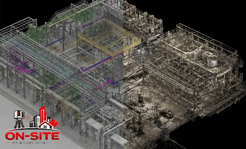
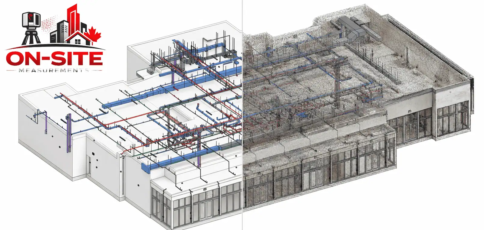
BIM-ready existing-condition models for coordination, retrofit planning, and engineering workflows. LOD confirmed per scope.
As-Built Drawings
Dimensioned 2D drawings for engineering reference, coordination documentation, and design inputs. Delivered as DWG and PDF.
CAD Drafting
2D CAD drawings from scan data for engineering disciplines and coordination documentation packages.
Drone Services
Aerial and exterior documentation for large sites, rooftop equipment areas, and outdoor infrastructure where ground-level scanning is impractical.
Common Project Types for Engineering Teams
These are the documentation scenarios most commonly supported for engineering teams working with existing buildings and infrastructure.
Mechanical Room Documentation
Point-cloud and CAD documentation of mechanical rooms, plant rooms, and equipment areas where precise spatial context supports equipment coordination and retrofit planning.
MEP Coordination Reference
Existing MEP system documentation captured to support coordination between disciplines during renovation or expansion projects.
Structural Reference Capture
Documentation of structural elements, column grids, slab thicknesses, and floor-to-ceiling dimensions needed as inputs for engineering review or calculation reference.
Retrofit Planning Support
Capture of existing conditions for planned equipment replacement, system upgrades, or building retrofit work where engineering teams need a reliable starting reference.
Field Verification Documentation
On-site measurement capture where engineering teams need to confirm drawing dimensions or resolve discrepancies between record drawings and actual conditions.
Exterior and Rooftop Documentation
Aerial and drone documentation of rooftop equipment, exterior utilities, and large-scale site conditions for engineering review and coordination reference.
Typical Deliverables for Engineering Teams
File formats and scope are confirmed before the engagement starts. Common outputs for engineering workflows include:
- Registered point clouds (LAS, LAZ, E57, RCP formats)
- 2D CAD drawings of existing conditions (DWG, PDF)
- Revit models at confirmed LOD for BIM-based engineering workflows
- IFC files for open BIM coordination
- Equipment-area documentation packages
- Sections and elevations of key spaces
- Photo documentation for reference
- Drone imagery and orthomosaic data for exterior areas
How a Documentation Project Works
Engineering documentation projects follow a consistent five-step process. Access planning and file-format requirements are confirmed early.
How It Works
- 01
Discovery
Scope discussion covering the discipline involved, areas to capture, required file formats, coordinate references, and any known access constraints.
- 02
Site Capture
On-site scanning of designated areas. Access protocols, safety requirements, and operational constraints are planned in advance.
- 03
Processing
Point cloud registration and delivery file preparation. CAD or BIM modeling follows for scopes that include those deliverables.
- 04
Delivery
Files delivered in confirmed formats. Engineers receive point clouds, CAD drawings, or BIM models as agreed in the scope.
- 05
Coordination
Questions about deliverable content or scope adjustments are handled post-delivery. Follow-on captures for additional areas can be scoped separately.
What to Prepare Before Requesting a Quote
Engineering documentation scoping is most efficient when the discipline, target area, and file format are known upfront. You do not need every detail before reaching out.
What to send before requesting a quote
- Engineering discipline involved (mechanical, electrical, structural, civil, or other)
- Target areas or spaces to document
- Required file format (E57, LAS, LAZ, RCP, DWG, RVT, IFC)
- Coordinate system or project reference requirements
- Access restrictions, safety protocols, or entry requirements
- Level of detail required for the deliverable
- Whether existing drawings are available to share
- Project timeline or engineering review deadline
- Known obstructions, hazards, or operational constraints
Service Areas
Projects Supported Across Canada
On-Site Measurements serves projects in major Canadian cities and regions. See all service areas on the locations hub.
All LocationsService Areas for Engineering Firms Teams
Related Industry Pages
Questions About Our Engineering Firms Service
Don't see your question? Email us directly.
How do engineering teams typically incorporate point clouds into their workflows?
Engineering teams use point clouds as spatial reference inputs in CAD and BIM software such as AutoCAD, Revit, and Navisworks. Point clouds can inform MEP coordination models, retrofit planning drawings, and structural reference documentation. The specific workflow depends on the engineering discipline and project type.
What file formats are available for the scan deliverables?
Common formats include E57, LAS, and LAZ for raw point cloud data, and RCP/RCS for Autodesk-native projects. CAD deliverables are available in DWG and PDF. BIM deliverables are available as Revit (RVT) or IFC files. File format is confirmed during scoping.
Does On-Site Measurements provide stamped or certified engineering drawings?
No. On-Site Measurements provides measurement and documentation support: point clouds, CAD drawings, and BIM models derived from field capture. The company does not provide professional engineering services, stamped drawings, engineering sign-off, or permit-ready engineering documents.
Can the scan data be used for MEP coordination in Revit?
Yes. Point clouds registered and formatted for Revit can be used as reference inputs for MEP coordination models. The level of detail and coordination scope are confirmed before the engagement. On-Site Measurements does not provide engineering design or coordination service, the documentation supports engineering teams doing their own coordination work.
How are access restrictions or operational constraints handled during scanning?
Access restrictions, safety protocols, and operational constraints are reviewed during the scoping process. Scanning sessions can be scheduled around operational windows, access availability, or security requirements. Any known restrictions should be shared before the site visit is scheduled.
What should an engineering team include in a quote request?
The most useful information includes the discipline involved, the specific areas to capture, the required file format, whether coordinate reference points are needed, access restrictions, and the project timeline. A brief description of the project is enough to start a scoping conversation.
Ready to discuss your engineering firms project?
Share the site, the scope, and the deliverable your project requires. We will respond with a clear plan.