TL;DR: Measured as-built drawings record the building itself: its rooms, walls, ceilings and elevations, measured on site and drafted for design or facility work. A land survey, and the surveyor's location reports that some people also call an "as-built survey", record the property: its legal boundaries and where buildings sit relative to them, and in Canada only a licensed land surveyor can prepare them. If your question is about the inside or shape of a building, you need measured drawings; if it is about property lines, setbacks or encroachments, you need a land surveyor.
The confusion is mostly about one phrase. To a design team, "as-builts" means drawings of a building as it stands. To a lawyer, lender or municipal permit desk, an "as-built survey" can mean a surveyor's document locating a newly built house against its lot lines. Ordering the wrong one costs time: a boundary document will not help an architect lay out a renovation, and a set of floor plans will not satisfy a lender asking about setbacks.
What is a measured as-built drawing?
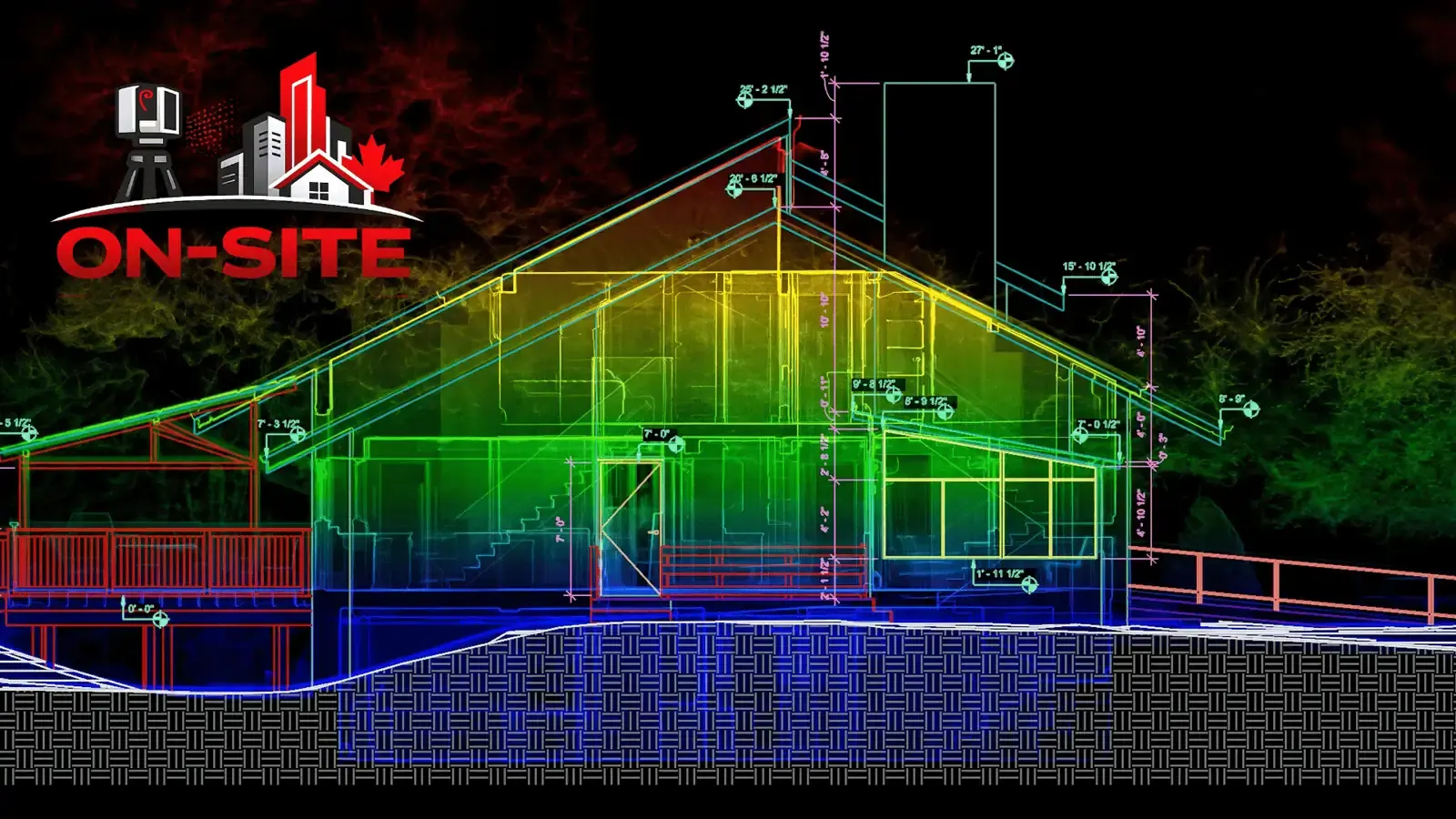
A measured as-built drawing is a dimensioned drawing of a building as it exists today, produced from a site measure or a laser scan rather than copied from older paperwork. A typical set includes floor plans, reflected ceiling plans, elevations and sections, delivered in DWG and PDF. The same work is also called existing conditions drawings, measured drawings or a measured building survey.
The Royal Institution of Chartered Surveyors, which publishes a widely used specification for this kind of work, treats measured surveys of land, buildings and utilities as their own category, separate from legal boundary work. The drawings are drafted by a technician from the measured data and show what was visible and accessible on the day; concealed elements inside walls are out of scope by default. For what goes into a set, see what an as-built floor plan is and our as-built drawing services.
What is a land survey, and what do surveyors call an "as-built"?
A land survey defines a property: its boundaries, dimensions, monuments, easements and, depending on the type, the location of buildings relative to those lines. In Canada this is regulated professional work, and each province names the most common building-location document differently:
- Ontario: the Association of Ontario Land Surveyors describes the Surveyor's Real Property Report, which shows boundaries, structures, setbacks, easements and encroachments and is signed by an Ontario Land Surveyor. Older names include building location survey and mortgage survey, and for a newly built house it is often called an as-built survey.
- Alberta: the Alberta Land Surveyors' Association describes the Real Property Report, a legal document showing property boundaries and the visible improvements relative to them.
- Quebec: the Quebec government explains the certificat de localisation, prepared by a land surveyor (arpenteur-géomètre), which reports on the property's current situation against titles, encroachments and applicable rules.
- British Columbia: survey certificates and building location surveys are prepared by a British Columbia Land Surveyor, a profession regulated by the Association of British Columbia Land Surveyors. Some municipalities ask for a building location survey when a new building goes up.
These documents answer legal and planning questions. They do not show room layouts, ceiling heights or interior walls, and they are not a substitute for design drawings.
How do the three compare?
| Document | What it shows | Who prepares it and why |
|---|---|---|
| Measured as-built drawings | The building: floor plans, ceilings, elevations, sections, dimensions of what is visible | A measurement firm or drafting technician, for renovation design, tenant fit-outs, facility records and coordination |
| Surveyor's as-built or location report | Where buildings sit on the lot, setbacks, encroachments, easements | A licensed land surveyor, for sales, mortgages, permits and compliance with setbacks |
| Land (boundary) survey | Legal property boundaries, monuments, dimensions of the parcel | A licensed land surveyor, for boundary questions, subdivisions, fences and disputes |
Who is allowed to prepare each one?
Boundary and building-location documents that carry legal weight are reserved for licensed land surveyors in each province, governed by bodies such as the AOLS in Ontario, the ALSA in Alberta, the Association of British Columbia Land Surveyors and the Ordre des arpenteurs-géomètres du Québec. Measured as-built drawings of a building's interior and exterior are not boundary work, and they are commonly produced by scanning and drafting firms.
On-Site Measurements produces measured as-built drawings, laser scans and models. It does not provide legal land surveying, boundary documentation, permit consulting or engineering sign-off. When a project needs a boundary or location document, that comes from a licensed surveyor in the province.
Where does "site measurement" fit?
Searches for building measuring services or commercial site measurement services are almost always about the building, not the lot. A tenant measuring a unit before a fit-out, a property manager updating floor plans or an architect checking a ceiling height needs measured as-built drawings, often captured with 3D laser scanning. The field visit records the building's geometry; the deliverable is drawings or a model the design team can work from.
For larger sites, measurement work sometimes ties into control set by a surveyor. When a scan has to align with a site grid or a design model's coordinates, the surveyor sets the control points and the scanning team works from them. Each party stays within its own scope.
When do you need both?
More often than people expect:
- Additions and extensions: the designer needs measured drawings of the existing building, and the permit may need a surveyor's document showing setbacks to the property line.
- Change of use or a new tenant in a standalone building: interior drawings for the fit-out, and possibly a location document if the exterior footprint changes.
- Property sales with renovation plans: the sale may call for a surveyor's report, while the buyer's architect will want measured drawings before design starts.
- Construction close-out: the contractor's record drawings, a scan of what was built, and a surveyor's final location survey can all be requested on the same project.
Confirm with your municipality which documents a permit needs, because requirements vary between authorities. Then scope each document with the right professional.
How do you order measured as-built drawings?
Send the address, the areas to document, the drawing views you need (floor plans, ceiling plans, elevations, sections) and your file format. If a surveyor is already involved, mention it so the measurement work can use their control where it helps. You will receive a fixed-scope quote within 24 hours. We work on projects across Canada, including as-built measuring services in Toronto, Vancouver, Calgary and Montreal.
Frequently asked questions
Is an as-built survey the same as as-built drawings?
Not usually. In real estate and permitting, an as-built survey often means a surveyor's document showing where a building sits on its lot. Measured as-built drawings show the building itself, inside and out. Ask what the document is for before ordering.
Can a laser scan replace a land survey?
No. A laser scan measures the geometry of what the scanner can see. It does not establish legal boundaries, which only a licensed land surveyor can do.
Do I need a land surveyor for a renovation?
It depends on the work and the municipality. Interior renovations usually need measured drawings, not a boundary survey. Projects that change the building's footprint, or that sit close to a property line, may need a surveyor's document for the permit.
Do as-built drawings show property lines?
No. Measured as-built drawings show the building. Property lines, easements and setbacks come from a land survey or a surveyor's location report.
Who sets control points when a scan must match site coordinates?
A surveyor sets the control, and the scanning team registers the scan to it. This is common on construction sites and large facilities.
Related reading
- What is an as-built floor plan?, how a measured plan differs from design and permit drawings
- As-built floor plans for commercial and industrial buildings, sheet types and detail decisions
- Scanning retail and commercial spaces before renovation or leasing, measurement for fit-outs and leases
- As-built drawing services, the service page for measured drawings
If you need measured drawings of a building, send the address, the areas, the views and the deadline. We will confirm the capture plan and return a fixed-scope quote within 24 hours. Request a quote or read more field notes.