TL;DR: Reality capture is the umbrella term for any method that records a real place as measurable digital data. 3D laser scanning is the specific method under that umbrella that most building, renovation and industrial projects actually need, because it produces the point cloud that measured drawings and BIM models are built from. If you are searching for "reality capture services" and your end goal is a floor plan, a section, a Revit model or a check of built work against a design, you are looking for a laser scanning provider, and the question to ask is about the deliverable, not the technology.
The two terms get used as if they were interchangeable, and in marketing copy they often are. That causes a practical problem for the person doing the buying. A search for reality capture returns scanner manufacturers, software platforms, drone operators, photo tour companies and measurement firms side by side, and it is not obvious which of them will turn up on site and hand you a drawing you can build from.
This article sorts the terms out, explains what each capture method is for, and gives you a short list of questions that get you to the right provider quickly.
What does "reality capture" actually mean?
Reality capture describes the whole family of techniques for turning a physical space into digital data that can be measured. The output is usually a point cloud (millions of individual measured points in three dimensions), a textured mesh, or a set of positioned images. The method used to get there varies, and that is where the confusion starts.
The term came out of the software side of the industry. Modelling platforms needed a name for the data that comes in from the field, whatever instrument captured it, and "reality capture" stuck. It is a useful word for a category. It is not a useful word for a purchase order, because it does not say what you will receive.
Under the reality capture umbrella you will find:
- Terrestrial laser scanning, a scanner on a tripod that captures a full sphere of measured points from each position.
- Mobile and SLAM scanning, a handheld or cart-mounted scanner that captures continuously while it moves through the space.
- Photogrammetry, overlapping photographs processed into a 3D model, most often from a drone over an exterior or a site.
- 360 imagery and virtual tours, positioned panoramic photographs that let someone walk through a space remotely.
Each of these is a legitimate reality capture method. Only some of them produce data you can draft a permit drawing from.
Where does 3D laser scanning fit inside reality capture?
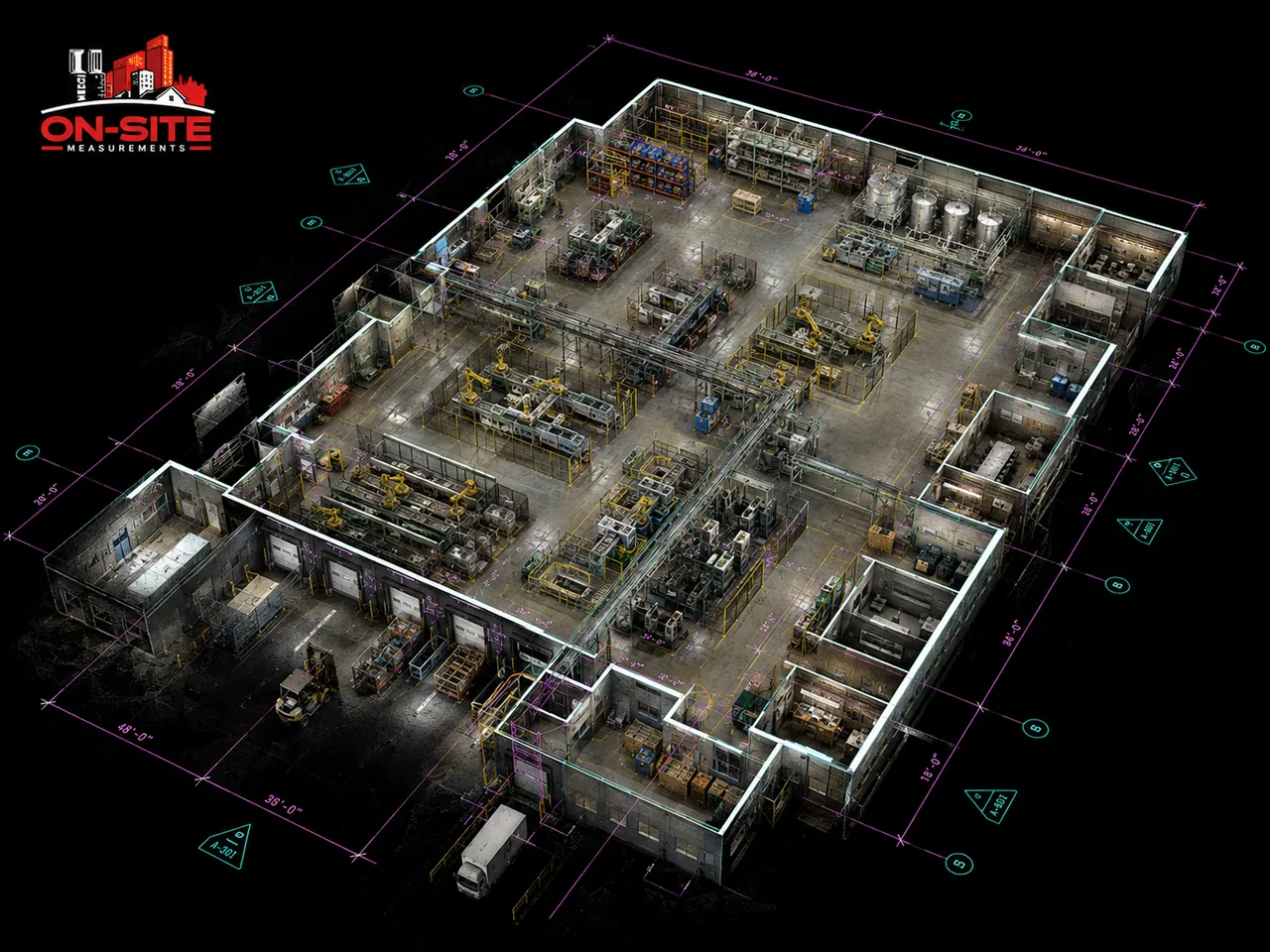
3D laser scanning is the core method for buildings and industrial facilities. The scanner sends out laser pulses, measures the distance and angle of each return, and assembles a dense point cloud of everything in its line of sight. Scans from many positions are then registered together into one coordinated dataset that covers the whole space.
That registered point cloud is what makes laser scanning different from the rest of the family for documentation work. It is a direct measurement of surfaces, not an estimate derived from photographs, and it holds up when a drafter or modeller needs to pull a dimension from it weeks later. Measured as-built drawings, Scan to BIM models and as-built verification reports all start from it.
There are two ways to run a laser scan on a building project. Static terrestrial scanning captures from fixed tripod positions and is generally chosen where controlled, consistent capture matters most. Mobile scanning moves through the space continuously and covers ground faster, with results that depend more on site conditions and how the data will be used. A good provider confirms which one fits during scoping rather than defaulting to whichever instrument is in the van.
What are the other capture methods for?
None of the other methods is a lesser version of laser scanning. They answer different questions, and the right project uses the right one.
| Method | What it produces | Where it fits |
|---|---|---|
| Terrestrial laser scanning | Registered point cloud of interiors, structures and equipment | As-built drawings, Scan to BIM, verification against a design model, MEP coordination |
| Mobile and SLAM scanning | Point cloud captured while walking the space | Large or repetitive floor plates where speed matters more than fine detail |
| Drone photogrammetry | Orthophotos, elevation models and meshes of exteriors and sites | Roofs, facades, earthworks, progress records and site context |
| 360 virtual tours | Navigable positioned photographs | Leasing, remote inspection, tenant handover and stakeholder walkthroughs |
The practical rule: if the deliverable is a dimensioned drawing or a model that someone will design against, the capture needs to be a laser scan. If the deliverable is a picture of the site for people who cannot visit, drone services or a 3D virtual tour will usually serve better and cost less. Many projects sensibly combine them: a laser scan of the interior for the drawing set, a drone flight for the roof and site plan, and a virtual tour for the leasing team.
Which one do you actually need?
Work backwards from what you will do with the data.
You need a floor plan, sections or elevations of an existing building. Laser scan, followed by drafting. This is the standard as-built documentation job, and the drawings are the deliverable. The point cloud can be included so the design team can check anything the drawings do not show.
You need a Revit model of an existing building or plant. Laser scan, followed by modelling to an agreed level of development. Scope the model by discipline and zone before capture so the field work covers what the modeller will need.
You need to know whether built work matches the design. Laser scan of the constructed work, aligned to the design model, reported as a deviation analysis. Timing matters here: it has to happen before finishes conceal the work. Our article on as-built verification and deviation analysis covers the workflow.
You need a record of a roof, a facade or a site. Drone capture. Interiors are out of reach for a drone, and a laser scanner is the wrong tool for a large open site.
You need people to walk through a space without travelling. Virtual tour. It is not a measurement product, and it should not be quoted as one.
You need a quick check of clear heights or a rough layout. This is sometimes a mobile scan, sometimes a conventional site measure. Ask the provider which they recommend and why, and make sure the answer is tied to what you will do with the result.
Why do search results for "reality capture services" look so mixed?
Because the phrase is used by three different kinds of business.
Hardware manufacturers use it to describe scanners and drones. Software companies use it to describe platforms that process and host the data. Service firms use it to describe going to site and measuring. All three are correct, and only the third will produce a drawing of your building.
When you are buying a service rather than a product, the phrase to search and to ask for is the deliverable: as-built drawings, Scan to BIM, or laser scanning for a specific building type in a specific city. Providers who work in your area will list those pages directly, for example 3D laser scanning in Toronto or Scan to BIM in Calgary, and a page written for that job tells you far more than a page written for the category.
What should you ask a reality capture provider before you book?
Six questions separate a documentation firm from a general capture vendor.
- What will I receive? File types, drawing views, model level of development, and whether the point cloud is included. If the answer is "the data", keep asking.
- Which capture method, and why? The answer should reference your building and your deliverable, not just the equipment on hand.
- How are the scans registered and checked? Individual scans have to be stitched into one dataset and verified. Unregistered raw scans are fast to hand over and slow to be useful.
- What is out of scope? Anything concealed behind walls, above ceilings or below floors cannot be scanned. A clear provider says this up front.
- What do you need from me to quote? A floor plan, the address, the areas in scope and the deliverable should be enough for a fixed-scope quote. See what to expect during a scanning site visit for what happens after that.
- Who drafts or models the data? Capture and drafting are different skills. Ask whether both are handled by the same team and where the drawing conventions come from.
How does this play out on Canadian projects?
The same logic holds across Canada, though the typical job changes by city. In Toronto and the GTA, the common request is a laser scan of a commercial floor plate or an older building ahead of renovation, delivered as measured drawings or a coordinated model. In Calgary, industrial and process facilities without reliable original drawings drive a lot of Scan to BIM work. In Vancouver, strata buildings and legacy drawing updates keep drafting services busy from scan data captured in a single visit.
In every case the capture method was chosen by the deliverable, not the other way round. That is the whole point of separating the two terms.
Frequently asked questions
Is reality capture the same as 3D laser scanning?
No. Reality capture is the category. 3D laser scanning is one method within it, and the one most building documentation projects rely on. All laser scanning is reality capture; not all reality capture is laser scanning.
Is photogrammetry as good as laser scanning for as-built drawings?
For interiors and structures that will be drafted or modelled, laser scanning is the standard because it measures surfaces directly. Photogrammetry is well suited to exteriors and sites captured by drone, and it is often combined with a laser scan rather than substituted for one.
Do I need to understand the technology to order a scan?
No. You need to know what you will do with the result. A good provider translates that into the right capture method and confirms the deliverable in writing before anyone comes to site.
Can one visit cover a laser scan, a drone flight and a virtual tour?
Often, yes, when the scope is agreed in advance and site access allows it. Combining them in one mobilisation is usually cheaper than three separate visits.
Related reading
- 3D laser scanning costs in Canada, how a quote is built
- Scan to BIM vs traditional as-builts, which deliverable fits which project
- As-built scanning for construction, where capture fits in a project timeline
- 3D laser scanning services, the service page for the method described here
If you are not sure which capture method your project needs, send the address, a floor plan if you have one, and a sentence about what the data is for. We will recommend the method, confirm the deliverable, and return a fixed-scope quote within 24 hours. Request a quote or browse more field notes.